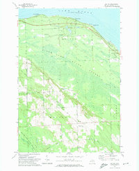
1971 Map of Moltke
USGS Topo · Published 1974About this map
Lake Huron defines the northern reaches of this coastal Michigan landscape, where the Forty Mile Point Lighthouse stands as a prominent navigational landmark. Inland from the shoreline developments at Evergreen Beach and Manitou Beach, the terrain transitions into the dense woods of the Black Lake State Forest. The rural character of the interior is shaped by a grid of local roads named for early families and geography, including Peltz Road, Sorgnfrei Road, and Clay Bank Road.
Find a feature on this map
49 named features on this map. Tap any name to fly to it.
Don’t see what you’re looking for? This feature index may not catch every label — zoom into the map to look around manually.
Map Details
Editions of this 1971 Moltke Map
This is the sole edition of this map. No revisions or reprints were ever made.
Other maps of this area

1954 · Alpena
USGS Topo · 1:250,000

1955 · Cheboygan
USGS Topo · 1:250,000

1957 · Alpena
USGS Topo · 1:250,000

1957 · Onaway
USGS Topo · 1:62,500

1958 · Cheboygan
USGS Topo · 1:250,000

1958 · Alpena
USGS Topo · 1:250,000

1958 · Grace
USGS Topo · 1:62,500

1969 · Alpena
USGS Topo · 1:250,000

1971 · Rogers City
USGS Topo · 1:24,000

1971 · Hawks
USGS Topo · 1:24,000