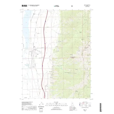
2020 Map of Mona
USGS Topo · Published 2020About this map
Mona occupies the heart of the Juab Valley in this detailed look at Utah's mountain-and-basin geography. The settlement is anchored by the Mona Reservoir to the west and the massive ascent of the Wasatch Range to the east, dominated by the peaks of Mt Nebo. Local landmarks such as Pioneer Memorial Park and the Mona Cem offer significant points of interest for genealogists and local historians tracking family roots in the area.
Find a feature on this map
76 named features on this map. Tap any name to fly to it.
Don’t see what you’re looking for? This feature index may not catch every label — zoom into the map to look around manually.
Map Details
Editions of this 2020 Mona Map
This is the sole edition of this map. No revisions or reprints were ever made.
Other maps of this area

1885 · Manti
USGS Topo · 1:250,000

1895 · Manti
USGS Topo · 1:250,000

1951 · Moroni
USGS Topo · 1:62,500

1951 · Santaquin
USGS Topo · 1:62,500

1951 · Nephi
USGS Topo · 1:62,500

1952 · Santaquin Peak
USGS Topo · 1:62,500

1956 · Price
USGS Topo · 1:250,000

1960 · Price
USGS Topo · 1:250,000

1962 · Price
USGS Topo · 1:250,000
1979 · Goshen
USGS Topo · 1:24,000