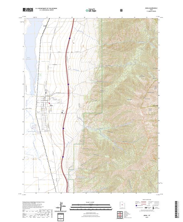
2023 Map of Mona
USGS Topo · Published 2023About this map
Mona sits at the base of the Wasatch Range, where the flat agricultural floor of the Juab Valley meets the rising slopes of the Uinta National Forest. The town grid, centered on Pioneer Memorial Park, reflects a classic Western settlement pattern, bordered to the north by the waters of the Mona Reservoir and the smaller Burriston Ponds. To the east, the terrain ascends sharply into the Mount Nebo Wilderness, a landscape defined by deep drainages such as Bear Canyon and Dry Canyon that carve through Cedar Ridge. These geographic features dictate the local road network, with routes like Old State Rte 91 and The Mona Rd skirting the valley floor. High-altitude landmarks like Mt Nebo and North Peak dominate the eastern skyline, providing a stark contrast to the nearby Mona Cemetery and the northern settlement of Starr.
Find a feature on this map
72 named features on this map. Tap any name to fly to it.
Don’t see what you’re looking for? This feature index may not catch every label — zoom into the map to look around manually.
Map Details
Editions of this 2023 Mona Map
This is the sole edition of this map. No revisions or reprints were ever made.
Other maps of this area

1885 · Manti
USGS Topo · 1:250,000

1895 · Manti
USGS Topo · 1:250,000

1951 · Moroni
USGS Topo · 1:62,500

1951 · Santaquin
USGS Topo · 1:62,500

1951 · Nephi
USGS Topo · 1:62,500

1952 · Santaquin Peak
USGS Topo · 1:62,500

1956 · Price
USGS Topo · 1:250,000

1960 · Price
USGS Topo · 1:250,000

1962 · Price
USGS Topo · 1:250,000
1979 · Goshen
USGS Topo · 1:24,000