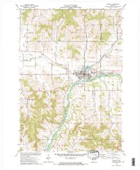
1932 Map of Mondovi
USGS Topo · Published 1932About this map
The Buffalo River meanders through the heart of this West-Central Wisconsin landscape, where the 1930s rural economy is defined by a dense network of one-room schoolhouses and small agricultural valley settlements. In the city of Mondovi, the convergence of State Highway No 34 and the Chicago and Northwestern railroad line centers the community around Mirror Lake. The surrounding townships, including Drammen and Naples, are characterized by a transition from high plateau farmlands to deeply incised valleys like German Valley and Armour Valley.
Find a feature on this map
76 named features on this map. Tap any name to fly to it.
Don’t see what you’re looking for? This feature index may not catch every label — zoom into the map to look around manually.
Map Details
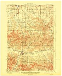
Editions of this 1932 Mondovi Map
2 editions found

Historical Maps of Pleasant Valley Through Time
3 maps found