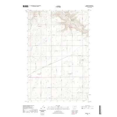
2020 Map of Mondovi
USGS Topo · Published 2020About this map
The settlement of Mondovi anchors this portion of Lincoln County, situated at the junction of Mondovi Rd N and Four Corners Rd E. The landscape is defined by a series of significant drainage features carving through the plateau, including Harker Canyon, Greene Canyon, and Mill Canyon. In the northwest, the terrain drops toward Cottonwood Cr, while the eastern portion is marked by the distinct profiles of Squaw Canyon and Saben Canyon. The road network reflects both modern transport and historical routes, notably Sunset Hwy and Old State Rte 2, which traverse the southern agricultural lands. Local family and place names are preserved in the naming of rural thoroughfares such as Olson Hills Rd E, Zeimantz Rd E, and Holderby Rd, providing a clear map of rural land division and residency patterns in the early 21st century.
Find a feature on this map
45 named features on this map. Tap any name to fly to it.
Don’t see what you’re looking for? This feature index may not catch every label — zoom into the map to look around manually.
Map Details
Editions of this 2020 Mondovi Map
This is the sole edition of this map. No revisions or reprints were ever made.
Other maps of this area

1944 · Wellpinit
USGS Topo · 1:62,500

1945 · Reardan
USGS Topo · 1:62,500

1948 · Turtle Lake
USGS Topo · 1:62,500

1950 · Turtle Lake
USGS Topo · 1:62,500

1953 · Reardan
USGS Topo · 1:62,500

1953 · Wellpinit
USGS Topo · 1:62,500

1953 · Ritzville
USGS Topo · 1:250,000

1955 · Spokane
USGS Topo · 1:250,000

1958 · Spokane
USGS Topo · 1:250,000

1959 · Ritzville
USGS Topo · 1:250,000