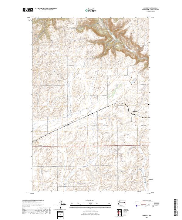
2023 Map of Mondovi
USGS Topo · Published 2023About this map
The agricultural landscape of Lincoln County centers on the small settlement of Mondovi, where transportation and geography intersect in the Palouse region. Local family names are etched into the road network, as seen with Zeimantz Rd E, Oehlwein Rd, and Ditmar Rd N, reflecting generations of land ownership and farming. The terrain is deeply incised in the north by a series of drainages including Mill Canyon, Greene Canyon, and Saben Canyon, which create a striking contrast to the flatter, cultivated fields to the south.
Find a feature on this map
45 named features on this map. Tap any name to fly to it.
Don’t see what you’re looking for? This feature index may not catch every label — zoom into the map to look around manually.
Map Details
Editions of this 2023 Mondovi Map
This is the sole edition of this map. No revisions or reprints were ever made.
Other maps of this area

1944 · Wellpinit
USGS Topo · 1:62,500

1945 · Reardan
USGS Topo · 1:62,500

1948 · Turtle Lake
USGS Topo · 1:62,500

1950 · Turtle Lake
USGS Topo · 1:62,500

1953 · Reardan
USGS Topo · 1:62,500

1953 · Wellpinit
USGS Topo · 1:62,500

1953 · Ritzville
USGS Topo · 1:250,000

1955 · Spokane
USGS Topo · 1:250,000

1958 · Spokane
USGS Topo · 1:250,000

1959 · Ritzville
USGS Topo · 1:250,000