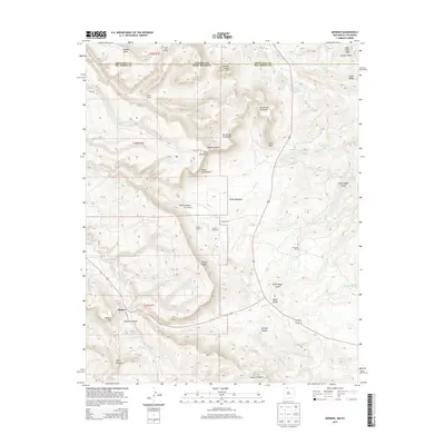
2013 Map of Monero
USGS Topo · Published 2013About this map
Monero serves as the focal point of this northern New Mexico landscape, situated at the crossroads of high desert mesas and deep drainage canyons. The map documents a significant ranching heritage, with numerous family-named holdings such as Abeyta Ranch, Torrez Ranch, and Gonzales Ranch scattered across the high ground. The terrain is defined by dramatic elevation shifts, from the heights of Abeyta Mesa and Mesa Diamante down to the winding course of Amargo Cr. The transition from the Colorado border into Rio Arriba County is marked by prominent landmarks like Crowley Peak and Monero Mtn. This record of the land preserves the names of early settlements and seasonal camps like Torres, providing a detailed look at the geography of the High Plateaus region before modern development altered these traditional ranching corridors.
Find a feature on this map
43 named features on this map. Tap any name to fly to it.
Don’t see what you’re looking for? This feature index may not catch every label — zoom into the map to look around manually.
Map Details
Editions of this 2013 Monero Map
This is the sole edition of this map. No revisions or reprints were ever made.
Other maps of this area

1913 · Summitville
USGS Topo · 1:125,000

1915 · Summitville
USGS Topo · 1:125,000

1945 · Durango
USGS Topo · 1:250,000

1953 · Durango
USGS Topo · 1:250,000

1954 · Durango
USGS Topo · 1:250,000

1954 · Aztec
USGS Topo · 1:250,000

1955 · Chama
USGS Topo · 1:62,500

1955 · Lumberton
USGS Topo · 1:62,500

1957 · Chromo
USGS Topo · 1:62,500

1957 · Chama Peak
USGS Topo · 1:62,500