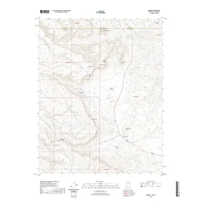
2020 Map of Monero
USGS Topo · Published 2020About this map
Monero sits at the base of Monero Mtn along the drainage of Amargo Cr, serving as a primary point of reference in this high-altitude landscape along the border of Colorado and New Mexico. The terrain is defined by a series of massive tablelands, including Vigil Mesa, Abeyta Mesa, and Briggs Mesa, separated by deep cuts like Miller Canyon and Webb Canyon. Local transit is marked by named corridors such as Cem Rd and Co Rd 349.
Find a feature on this map
36 named features on this map. Tap any name to fly to it.
Don’t see what you’re looking for? This feature index may not catch every label — zoom into the map to look around manually.
Map Details
Editions of this 2020 Monero Map
This is the sole edition of this map. No revisions or reprints were ever made.
Other maps of this area

1913 · Summitville
USGS Topo · 1:125,000

1915 · Summitville
USGS Topo · 1:125,000

1945 · Durango
USGS Topo · 1:250,000

1953 · Durango
USGS Topo · 1:250,000

1954 · Durango
USGS Topo · 1:250,000

1954 · Aztec
USGS Topo · 1:250,000

1955 · Chama
USGS Topo · 1:62,500

1955 · Lumberton
USGS Topo · 1:62,500

1957 · Chromo
USGS Topo · 1:62,500

1957 · Chama Peak
USGS Topo · 1:62,500