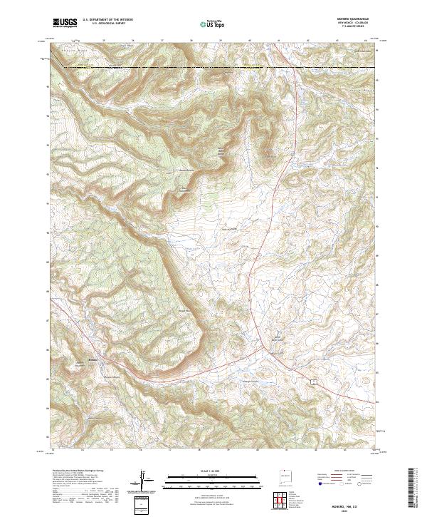
2023 Map of Monero
USGS Topo · Published 2023About this map
Monero sits at the base of Monero Mountain, serving as a focal point in a landscape defined by deep canyons and high mesas along the border between Archuleta and Rio Arriba counties. This terrain is characterized by dramatic elevation shifts, where Vigil Mesa and Abeyta Mesa overlook the winding paths of Abeyta Canyon and Webb Canyon. The drainage patterns of Amargo Creek and its associated Amargo Canyon dictate the historical movement through the region, providing a natural corridor south of Eagle Point.
Find a feature on this map
36 named features on this map. Tap any name to fly to it.
Don’t see what you’re looking for? This feature index may not catch every label — zoom into the map to look around manually.
Map Details
Editions of this 2023 Monero Map
This is the sole edition of this map. No revisions or reprints were ever made.
Other maps of this area

1913 · Summitville
USGS Topo · 1:125,000

1915 · Summitville
USGS Topo · 1:125,000

1945 · Durango
USGS Topo · 1:250,000

1953 · Durango
USGS Topo · 1:250,000

1954 · Durango
USGS Topo · 1:250,000

1954 · Aztec
USGS Topo · 1:250,000

1955 · Chama
USGS Topo · 1:62,500

1955 · Lumberton
USGS Topo · 1:62,500

1957 · Chromo
USGS Topo · 1:62,500

1957 · Chama Peak
USGS Topo · 1:62,500