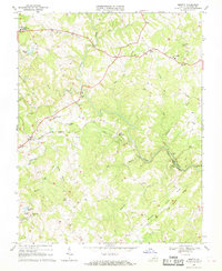
1967 Map of Moneta
USGS Topo · Published 1969About this map
Goose Creek defines the local topography of this Bedford County landscape, winding past Stone Mountain and through a network of rural settlements in the late 1960s. The village of Moneta serves as a focal point along the Norfolk and Western rail line, which cuts across the terrain near Bethlehem Ch and Promised Land Ch. The map captures a transition in the rural economy, showing established agricultural centers like Body Camp alongside specialized sites such as Prison Camp No 24 and the Saunders Pond area.
Find a feature on this map
44 named features on this map. Tap any name to fly to it.
Don’t see what you’re looking for? This feature index may not catch every label — zoom into the map to look around manually.
Map Details
Editions of this 1967 Moneta Map
Other maps of this area

1890 · Roanoke
USGS Topo · 1:125,000

1891 · Roanoke
USGS Topo · 1:125,000

1892 · Lynchburg
USGS Topo · 1:125,000

1947 · Roanoke
USGS Topo · 1:250,000

1950 · Goode
USGS Topo · 1:62,500

1950 · Peaks of Otter
USGS Topo · 1:62,500

1951 · Moneta
USGS Topo · 1:62,500

1951 · Altavista
USGS Topo · 1:62,500

1959 · Roanoke
USGS Topo · 1:250,000

1963 · Roanoke
USGS Topo · 1:250,000