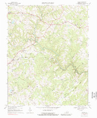
1967 Map of Moneta
USGS Topo · Published 1989About this map
Goose Creek winds through this section of Bedford County, carving a path through a landscape of steep ridges and creek bottoms. The Norfolk and Western railway cuts across the terrain, serving small communities like Moneta and passing landmarks such as the Haden Bridge and a nearby railroad Tunnel. The geography is defined by a dense network of watercourses including Stony Fork, Difficult Creek, and Body Camp Creek, which shaped the early settlement patterns of the region.
Find a feature on this map
45 named features on this map. Tap any name to fly to it.
Don’t see what you’re looking for? This feature index may not catch every label — zoom into the map to look around manually.
Map Details
Editions of this 1967 Moneta Map
Other maps of this area

1890 · Roanoke
USGS Topo · 1:125,000

1891 · Roanoke
USGS Topo · 1:125,000

1892 · Lynchburg
USGS Topo · 1:125,000

1947 · Roanoke
USGS Topo · 1:250,000

1950 · Goode
USGS Topo · 1:62,500

1950 · Peaks of Otter
USGS Topo · 1:62,500

1951 · Moneta
USGS Topo · 1:62,500

1951 · Altavista
USGS Topo · 1:62,500

1959 · Roanoke
USGS Topo · 1:250,000

1963 · Roanoke
USGS Topo · 1:250,000