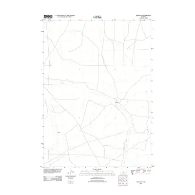
2012 Map of Moneta SE
USGS Topo · Published 2012About this map
Meigh Ranch sits as a primary landmark in this high-desert region of Natrona County, marking a site of habitation and agricultural activity in an otherwise sparsely settled landscape. The terrain is defined by the intermittent drainage of Deer Cr and Canyon Cr, which carve through the open plains and lead toward the distinctive geological formation known as Black Rocks. The network of unimproved roads and the more established Deer Creek Rd reflect a ranching economy where distance and access to seasonal water sources dictate the placement of local infrastructure. This 2012 survey captures the character of the Wyoming rangeland, showing how historical land use persists through isolated homesteads and named geographic features that have long guided travelers across the basin.
Find a feature on this map
5 named features on this map. Tap any name to fly to it.
Don’t see what you’re looking for? This feature index may not catch every label — zoom into the map to look around manually.
Map Details
Editions of this 2012 Moneta SE Map
This is the sole edition of this map. No revisions or reprints were ever made.
Other maps of this area

1952 · Seventy-one Reservoir
USGS Topo · 1:24,000

1952 · Moneta
USGS Topo · 1:24,000

1952 · Arminto SW
USGS Topo · 1:24,000

1952 · Love Ranch
USGS Topo · 1:24,000

1952 · Madden
USGS Topo · 1:24,000

1952 · Arminto NW
USGS Topo · 1:24,000

1952 · Moneta SE
USGS Topo · 1:24,000

1952 · Miles Ranch
USGS Topo · 1:24,000

1952 · Ervay Basin
USGS Topo · 1:24,000

1955 · Arminto
USGS Topo · 1:250,000