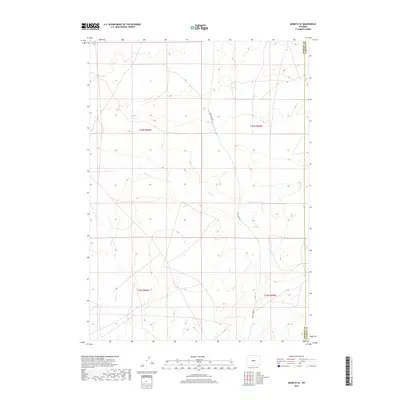
2017 Map of Moneta SE
USGS Topo · Published 2017About this map
The high plains of central Wyoming are defined by the convergence of drainage networks and historical land divisions along the border of Fremont Co and Natrona Co. This 2017 topographic record captures a landscape shaped by seasonal watercourses like Deer Cr and Canyon Cr, which carve their way through the arid terrain of the Wind River Basin. The presence of Deer Creek Rd provides one of the few managed transportation routes through this section of the state, serving as a vital link for the ranching operations and public land management in the region. The map meticulously documents the Township and Range system, including t36n r90w and t35n r89w, offering a clear view of the cadastral framework that still dictates property boundaries and grazing allotments in the modern era.
Find a feature on this map
8 named features on this map. Tap any name to fly to it.
Don’t see what you’re looking for? This feature index may not catch every label — zoom into the map to look around manually.
Map Details
Editions of this 2017 Moneta SE Map
This is the sole edition of this map. No revisions or reprints were ever made.
Other maps of this area

1952 · Seventy-one Reservoir
USGS Topo · 1:24,000

1952 · Moneta
USGS Topo · 1:24,000

1952 · Arminto SW
USGS Topo · 1:24,000

1952 · Love Ranch
USGS Topo · 1:24,000

1952 · Madden
USGS Topo · 1:24,000

1952 · Arminto NW
USGS Topo · 1:24,000

1952 · Moneta SE
USGS Topo · 1:24,000

1952 · Miles Ranch
USGS Topo · 1:24,000

1952 · Ervay Basin
USGS Topo · 1:24,000

1955 · Arminto
USGS Topo · 1:250,000