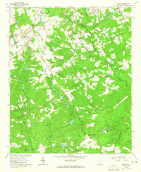
1964 Map of Monetta
USGS Topo · Published 1965About this map
Monetta serves as the focal point of this mid-1960s survey, situated where the Southern railroad tracks bisect a landscape dominated by agricultural fields and woodland. The intersection of three counties — Saluda, Aiken, and Lexington — creates a complex social geography reflected in the numerous community centers and family burial grounds scattered across the terrain. Genealogists will find a dense concentration of named cemeteries, including Watson, Williams, and Quattlebaum, which anchor the histories of local farmsteads. Cultural landmarks of the era are clearly marked, from the Drive-in Theater near the town center to the Monetta Sch. The drainage patterns of Clouds Creek, Chinquapin Creek, and McTier Creek define the ridges and valleys, with the notable Chinquapin Falls providing a rare natural waypoint in the southeastern woods, while the Two Notch Road remains a primary artery for local travel.
Find a feature on this map
45 named features on this map. Tap any name to fly to it.
Don’t see what you’re looking for? This feature index may not catch every label — zoom into the map to look around manually.
Map Details
Editions of this 1964 Monetta Map
2 editions found
Other maps of this area

1920 · Aiken
USGS Topo · 1:48,000

1921 · Aiken
USGS Topo · 1:62,500

1943 · Aiken
USGS Topo · 1:62,500

1944 · Gilbert
USGS Topo · 1:62,500

1944 · Seivern
USGS Topo · 1:62,500

1954 · Augusta
USGS Topo · 1:250,000

1957 · Augusta
USGS Topo · 1:250,000

1958 · Augusta
USGS Topo · 1:250,000

1961 · Augusta
USGS Topo · 1:250,000

1962 · Augusta
USGS Topo · 1:250,000