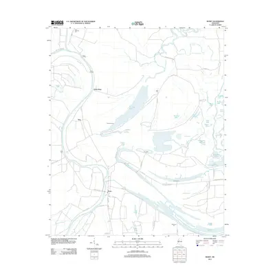
2012 Map of Money
USGS Topo · Published 2012About this map
The Tallahatchie River and Yalobusha River define the intricate delta landscape of this Mississippi territory. The small community of Money sits at a geographic crossroads where Money Bayou and Robinson Bayou meet, surrounded by a dense network of plantation roads and landings. Historically significant landing sites such as Beulah Landing, Ruby Landing, and Peebles Landing mark the riverbanks, indicating a legacy of water-based transport and commerce.
Find a feature on this map
68 named features on this map. Tap any name to fly to it.
Don’t see what you’re looking for? This feature index may not catch every label — zoom into the map to look around manually.
Map Details
Editions of this 2012 Money Map
This is the sole edition of this map. No revisions or reprints were ever made.
Other maps of this area

1931 · Schlater
USGS Topo · 1:48,000

1931 · Sumner
USGS Topo · 1:48,000

1932 · Philipp
USGS Topo · 1:48,000

1934 · Schlater
USGS Topo · 1:62,500

1935 · Sumner
USGS Topo · 1:62,500

1935 · Philipp
USGS Topo · 1:62,500

1936 · Greenwood
USGS Topo · 1:62,500

1939 · Schlater
USGS Topo · 1:62,500

1939 · Sumner
USGS Topo · 1:62,500

1939 · Philipp
USGS Topo · 1:62,500