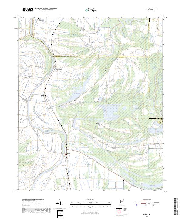
2024 Map of Money
USGS Topo · Published 2024About this map
The Tallahatchie River meanders through this landscape on the border of Leflore, Tallahatchie, and Grenada counties, anchoring a complex network of wetlands and bayous. The small community of Money serves as a focal point in the southern portion of the sheet, connected to the surrounding countryside by roads such as Pleasantview Plantation Rd and Money Rd. The geography is defined by its low-lying hydrology, featuring numerous oxbows and marshy areas including McIntyre Scatters, Six Mile Lake, and Worship Lake.
Find a feature on this map
74 named features on this map. Tap any name to fly to it.
Don’t see what you’re looking for? This feature index may not catch every label — zoom into the map to look around manually.
Map Details
Editions of this 2024 Money Map
This is the sole edition of this map. No revisions or reprints were ever made.
Other maps of this area

1931 · Schlater
USGS Topo · 1:48,000

1931 · Sumner
USGS Topo · 1:48,000

1932 · Philipp
USGS Topo · 1:48,000

1934 · Schlater
USGS Topo · 1:62,500

1935 · Sumner
USGS Topo · 1:62,500

1935 · Philipp
USGS Topo · 1:62,500

1936 · Greenwood
USGS Topo · 1:62,500

1939 · Schlater
USGS Topo · 1:62,500

1939 · Sumner
USGS Topo · 1:62,500

1939 · Philipp
USGS Topo · 1:62,500