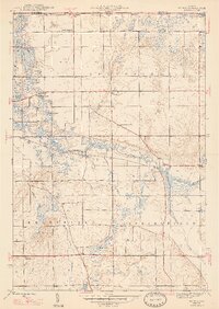
1947 Map of Mongo
USGS Topo · Published 1947About this map
Pigeon River meanders across this northern Indiana landscape, anchoring a community defined by its waterways and small crossroads settlements in the years following World War II. The village of Mongo serves as a focal point near the Mongo Reservoir, while nearby Brighton and Plato represent the rural hubs of the era. The presence of Nasby Dam and Ontario Mill Pond suggests a local economy and landscape still intimately tied to water management and milling.
Find a feature on this map
31 named features on this map. Tap any name to fly to it.
Don’t see what you’re looking for? This feature index may not catch every label — zoom into the map to look around manually.
Map Details
Editions of this 1947 Mongo Map
2 editions found
Other maps of this area

1940 · Orland
USGS Topo · 1:24,000

1941 · Orland
USGS Topo · 1:24,000

1942 · Stroh
USGS Topo · 1:24,000

1947 · Mongo
USGS Topo · 1:24,000

1947 · Lagrange
USGS Topo · 1:24,000

1947 · Wolcottville
USGS Topo · 1:24,000

1947 · Oliver Lake
USGS Topo · 1:24,000

1953 · Fort Wayne
USGS Topo · 1:250,000

1956 · Fort Wayne
USGS Topo · 1:250,000

1959 · Wolcottville
USGS Topo · 1:24,000