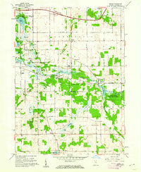
1960 Map of Mongo
USGS Topo · Published 1973About this map
The Pigeon River State Game Preserve dominates this northeastern Indiana landscape, following the winding course of the Pigeon River through the townships of Greenfield, Bloomfield, and Springfield. This 1960 revision captures the area’s distinct combination of conservation land and small-town settlement, centered on the village of Mongo near the Mongo Reservoir. To the north, the Indiana East-West Toll Road cuts a modern transit corridor across the rural grid, contrasting with the local economy represented by the Ontario Millpond and Curtis Creek Fish Hatchery. Genealogists will find significant detail in the family-named landmarks and rural institutions, including the Bontrager Cem, English Prairie Ch, and the Hoff Sch. The terrain is defined by a series of glacial lakes such as Cedar Lake, Duff Lake, and Donaldson Lake, illustrating the post-glacial topography of LaGrange County.
Find a feature on this map
45 named features on this map. Tap any name to fly to it.
Don’t see what you’re looking for? This feature index may not catch every label — zoom into the map to look around manually.
Map Details
Editions of this 1960 Mongo Map
2 editions found
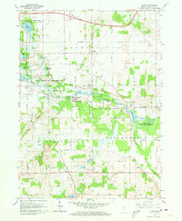
Other maps of this area

1940 · Orland
USGS Topo · 1:24,000

1941 · Orland
USGS Topo · 1:24,000

1942 · Stroh
USGS Topo · 1:24,000

1947 · Mongo
USGS Topo · 1:24,000

1947 · Lagrange
USGS Topo · 1:24,000

1947 · Wolcottville
USGS Topo · 1:24,000

1947 · Oliver Lake
USGS Topo · 1:24,000

1953 · Fort Wayne
USGS Topo · 1:250,000

1956 · Fort Wayne
USGS Topo · 1:250,000

1959 · Wolcottville
USGS Topo · 1:24,000