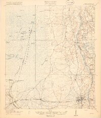
1918 Map of Moniac
USGS Topo · Published 1918About this map
The Okefenokee Swamp dominates this 1918 landscape, defining the western edge of the Georgia-Florida borderlands. To the east of the swamp's Grand Prairie and Bee Gum Prairie, the prominent Trail Ridge forms a natural corridor for early settlements and schools. Along this rise, rural life is marked by the presence of Chesser School, Toledo School, and Stave Branch School.
Find a feature on this map
55 named features on this map. Tap any name to fly to it.
Don’t see what you’re looking for? This feature index may not catch every label — zoom into the map to look around manually.
Map Details
Editions of this 1918 Moniac Map
2 editions found
Other maps of this area

1917 · Cambon
USGS Topo · 1:62,500

1917 · Boulogne
USGS Topo · 1:62,500

1917 · Macclenny
USGS Topo · 1:62,500

1917 · Hilliard
USGS Topo · 1:62,500

1918 · Folkston
USGS Topo · 1:62,500

1918 · Moniac
USGS Topo · 1:62,500

1918 · Cambon
USGS Topo · 1:62,500

1918 · Macclenny
USGS Topo · 1:62,500

1919 · Hilliard
USGS Topo · 1:62,500

1919 · Boulogne
USGS Topo · 1:62,500