
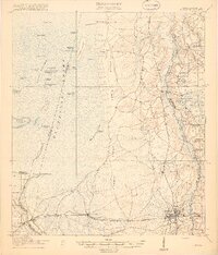
1918 Map of Moniac
USGS Topo · Published 1918About this map
Trail Ridge dominates the central landscape of this 1917 survey, separating the eastern pine forests from the expansive Okeefenokee Swamp to the west. This distinctive geological formation serves as the high ground for the regional travel network, including the Toledo School and Chesser School, which served dispersed families living on the edge of the wetlands. Within the swamp, elevated landmasses like Chesser Island and Big Cypress Camp Island rise above the Grand Prairie, providing vital footing in the marshy interior. To the south, the village of St George serves as a local hub along the Georgia Southern and Florida railroad, while the St Marys River defines the winding border between Georgia and Florida. The presence of Olivers Mill and numerous rural schools like Stave Branch School and Hall Branch School reflect a community deeply integrated with the lumbering and naval stores industries of the early twentieth century.
Find a feature on this map
60 named features on this map. Tap any name to fly to it.
Don’t see what you’re looking for? This feature index may not catch every label — zoom into the map to look around manually.
Map Details
Editions of this 1918 Moniac Map
2 editions found
Other maps of this area

1917 · Cambon
USGS Topo · 1:62,500

1917 · Boulogne
USGS Topo · 1:62,500

1917 · Macclenny
USGS Topo · 1:62,500

1917 · Hilliard
USGS Topo · 1:62,500

1918 · Folkston
USGS Topo · 1:62,500

1918 · Cambon
USGS Topo · 1:62,500

1918 · Macclenny
USGS Topo · 1:62,500

1919 · Hilliard
USGS Topo · 1:62,500

1919 · Boulogne
USGS Topo · 1:62,500

1942 · Moniac
USGS Topo · 1:62,500