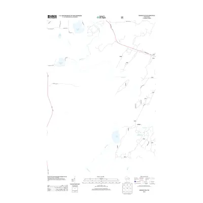
2013 Map of Monico NE
USGS Topo · Published 2013About this map
Eagle River winds through the northern Wisconsin woodlands of Oneida County, connecting a dense network of glacial lakes and wetlands in the early twenty-first century. The settlement of Atkins serves as a central point of interest, situated near Atkins Lake and the Wildcat Cr Impoundment. The map reveals a landscape defined by its waterways, including James Lake, Crooked Lake, and Margaret Lake, which are linked by local connectors such as State Farm Rd and Rydzewski Rd. This 2013 survey illustrates the modern intersection of recreational geography and forest management, highlighted by numerous forest roads like Forest Rd 3910 and Forest Rd 2861 that provide access to the interior. The presence of Hunting Camp Rd and various creek systems, such as Monico Cr and Mud Cr, suggests a region long utilized for seasonal sporting and natural resource management.
Find a feature on this map
37 named features on this map. Tap any name to fly to it.
Don’t see what you’re looking for? This feature index may not catch every label — zoom into the map to look around manually.
Map Details
Editions of this 2013 Monico NE Map
This is the sole edition of this map. No revisions or reprints were ever made.
Other maps of this area

1928 · Three Lakes
USGS Topo · 1:48,000

1938 · Alvin
USGS Topo · 1:48,000

1938 · Three Lakes
USGS Topo · 1:48,000

1939 · Crandon
USGS Topo · 1:48,000

1940 · Monico
USGS Topo · 1:48,000

1941 · Crandon
USGS Topo · 1:48,000

1945 · Three Lakes
USGS Topo · 1:48,000

1946 · Alvin
USGS Topo · 1:48,000

1947 · Crandon
USGS Topo · 1:48,000

1950 · Monico
USGS Topo · 1:48,000