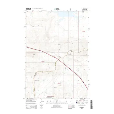
2014 Map of Monida
USGS Topo · Published 2014About this map
Monida Pass serves as a critical geographic gateway on this 2014 survey, marking where the interstate and local routes cross the Continental Divide. The small settlement of Monida sits at this high-elevation transit point, positioned between the mountain peaks and the southern edge of the Centennial Valley. This area is defined by its complex hydrologic split, where waters drain north toward the Lima Reservoir or south through the headwaters of the Targhee National Forest. The landscape is etched with steep drainages and named summits like Pinetop Hill, while several ranch roads, including Grover Ranch Rd and McDowell Rd, provide access to the high-country terrain. Local history is tied to the movement of people and livestock through the pass, reflected in the network of creeks such as Beaver Cr and Modoc Cr that cut through Tenpin Gulch and the surrounding slopes.
Find a feature on this map
27 named features on this map. Tap any name to fly to it.
Don’t see what you’re looking for? This feature index may not catch every label — zoom into the map to look around manually.
Map Details
Editions of this 2014 Monida Map
This is the sole edition of this map. No revisions or reprints were ever made.
Other maps of this area

1955 · Dubois
USGS Topo · 1:250,000

1957 · Paul Reservoir
USGS Topo · 1:62,500

1958 · Dubois
USGS Topo · 1:250,000

1968 · Corral Creek
USGS Topo · 1:24,000

1968 · Lima Dam
USGS Topo · 1:24,000

1968 · Snowline
USGS Topo · 1:24,000

1968 · Monida
USGS Topo · 1:24,000

1968 · Henry Gulch
USGS Topo · 1:24,000
1968 · Wolverine Creek
USGS Topo · 1:24,000

1972 · Spencer North
USGS Topo · 1:24,000