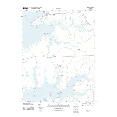
2011 Map of Monie
USGS Topo · Published 2011About this map
Monie Bay and the surrounding marshlands of Somerset County define this coastal landscape, where the Wicomico River meets the Manokin River. The area is characterized by a high density of named points and necks, such as Mongrel Neck and Monie Neck, reflecting a long history of maritime navigation and water-based livelihoods. Small settlements like Oriole and Venton are tucked inland, often centered around local landmarks like the Oriole Post Office or Grace Cemetery.
Find a feature on this map
110 named features on this map. Tap any name to fly to it.
Don’t see what you’re looking for? This feature index may not catch every label — zoom into the map to look around manually.
Map Details
Editions of this 2011 Monie Map
This is the sole edition of this map. No revisions or reprints were ever made.
Other maps of this area

1901 · Salisbury
USGS Topo · 1:62,500

1903 · Nanticoke
USGS Topo · 1:62,500

1903 · Deal Island
USGS Topo · 1:62,500

1942 · Terrapin Sand Point
USGS Topo · 1:24,000

1942 · Marion
USGS Topo · 1:24,000

1942 · Deal Island
USGS Topo · 1:24,000

1942 · Monie
USGS Topo · 1:24,000

1942 · Wetipquin
USGS Topo · 1:24,000

1942 · Kingston
USGS Topo · 1:24,000

1942 · Princess Anne
USGS Topo · 1:24,000