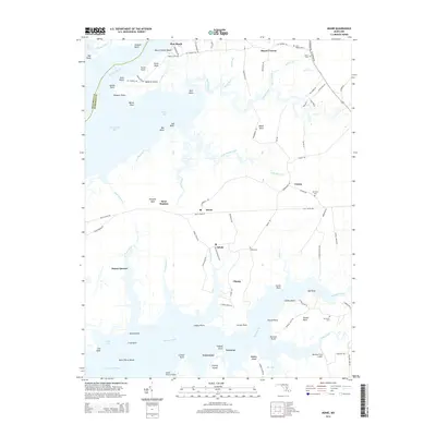
2014 Map of Monie
USGS Topo · Published 2014About this map
Monie Bay and the surrounding marshlands of Somerset County define this intricate coastal landscape where the Wicomico River meets the Chesapeake Bay. The map documents a network of small, established communities connected by rural corridors like Deal Island Rd and Mt Vernon Rd. For genealogists, the sheet is an excellent resource, locating numerous family and church burial grounds including Asbury Cem, Grace Cem, and the John Wesley Cem near Mount Vernon. The land is fragmented by deep tidal inlets such as Little Monie Creek and Geanquakin Cr, creating isolated necks like Victor Neck and Monie Neck. Cultural and economic hubs are represented by the settlements of Oriole, Venton, and Dames Quarter, while the Bluemel Field Airport provides a modern aviation landmark near the southern banks of the Manokin River.
Find a feature on this map
110 named features on this map. Tap any name to fly to it.
Don’t see what you’re looking for? This feature index may not catch every label — zoom into the map to look around manually.
Map Details
Editions of this 2014 Monie Map
This is the sole edition of this map. No revisions or reprints were ever made.
Other maps of this area

1901 · Salisbury
USGS Topo · 1:62,500

1903 · Nanticoke
USGS Topo · 1:62,500

1903 · Deal Island
USGS Topo · 1:62,500

1942 · Terrapin Sand Point
USGS Topo · 1:24,000

1942 · Marion
USGS Topo · 1:24,000

1942 · Deal Island
USGS Topo · 1:24,000

1942 · Monie
USGS Topo · 1:24,000

1942 · Wetipquin
USGS Topo · 1:24,000

1942 · Kingston
USGS Topo · 1:24,000

1942 · Princess Anne
USGS Topo · 1:24,000