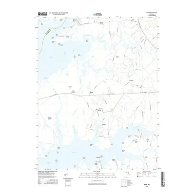
2016 Map of Monie
USGS Topo · Published 2016About this map
The Wicomico River and Monie Bay define the transition from the Chesapeake into the tidal lowlands of Somerset County. This survey detail highlights the intricate water network of the Eastern Shore, where long necks of land like Monie Neck and Mongrel Neck extend into expansive marshes. Small inland settlements such as Oriole, Champ, and Venton serve as the primary hubs, connected by a network of rural routes including Deal Island Rd. Local genealogy and community history are anchored by several named burial sites, including Oriole Cem and All Saints Cem. The southern reach of the map transitions into the Manokin River basin, showing the importance of maritime geography to the development of landing points like Fairmount and Iverness.
Find a feature on this map
120 named features on this map. Tap any name to fly to it.
Don’t see what you’re looking for? This feature index may not catch every label — zoom into the map to look around manually.
Map Details
Editions of this 2016 Monie Map
This is the sole edition of this map. No revisions or reprints were ever made.
Other maps of this area

1901 · Salisbury
USGS Topo · 1:62,500

1903 · Nanticoke
USGS Topo · 1:62,500

1903 · Deal Island
USGS Topo · 1:62,500

1942 · Terrapin Sand Point
USGS Topo · 1:24,000

1942 · Marion
USGS Topo · 1:24,000

1942 · Deal Island
USGS Topo · 1:24,000

1942 · Monie
USGS Topo · 1:24,000

1942 · Wetipquin
USGS Topo · 1:24,000

1942 · Kingston
USGS Topo · 1:24,000

1942 · Princess Anne
USGS Topo · 1:24,000