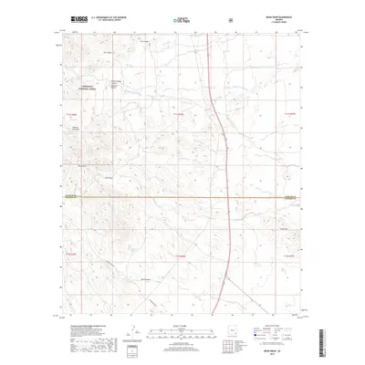
2018 Map of Monk Draw
USGS Topo · Published 2018About this map
The Coronado National Forest defines the northwestern corner of this landscape, where the southern foothills of the Pinaleno Mountains begin their descent toward the desert floor. This arid environment is shaped by a complex system of drainage channels and ephemeral washes, most notably Monk Draw and the various branches of Dial Wash. The terrain is punctuated by significant water-dependent sites such as Sycamore Spring, Whisky Spring, and Hackberry Spring, which were historically critical for ranching operations in this part of Cochise County. Evidence of land use is visible through cattle-related infrastructure like Dial Tank and the network of primitive routes, including N Monk Ranch Rd, that navigate the deep incisions of Owl Canyon and Dial Canyon. The map also captures the administrative boundary between Graham and Cochise counties as it cuts across the undulating topography of the Fisher Hills.
Find a feature on this map
27 named features on this map. Tap any name to fly to it.
Don’t see what you’re looking for? This feature index may not catch every label — zoom into the map to look around manually.
Map Details
Editions of this 2018 Monk Draw Map
This is the sole edition of this map. No revisions or reprints were ever made.
Other maps of this area

1922 · Willcox
USGS Topo · 1:125,000

1942 · Mt. Graham
USGS Topo · 1:62,500

1943 · Willcox
USGS Topo · 1:62,500

1944 · Fisher Hills
USGS Topo · 1:62,500

1945 · Mt. Graham
USGS Topo · 1:62,500

1954 · Silver City
USGS Topo · 1:250,000

1957 · Luzena
USGS Topo · 1:62,500

1958 · Silver City
USGS Topo · 1:250,000

1958 · Willcox
USGS Topo · 1:62,500

1962 · Silver City
USGS Topo · 1:250,000