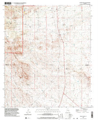
1996 Map of Monk Draw
USGS Topo · Published 2003About this map
The high desert landscape of the Graham and Cochise County border is defined by a series of dramatic drainages and ranching outposts. The eastern slopes of the Coronado National Forest descend into the plains, marked by Owl Canyon and Sycamore Canyon. Human presence is anchored by established cattle operations like Ten Ranch and Monk Ranch, which rely on a network of water sources including Sycamore Well, Whisky Spring, and the seasonal flow of Monk Draw.
Find a feature on this map
40 named features on this map. Tap any name to fly to it.
Don’t see what you’re looking for? This feature index may not catch every label — zoom into the map to look around manually.
Map Details
Editions of this 1996 Monk Draw Map
This is the sole edition of this map. No revisions or reprints were ever made.
Other maps of this area

1922 · Willcox
USGS Topo · 1:125,000

1942 · Mt. Graham
USGS Topo · 1:62,500

1943 · Willcox
USGS Topo · 1:62,500

1944 · Fisher Hills
USGS Topo · 1:62,500

1945 · Mt. Graham
USGS Topo · 1:62,500

1954 · Silver City
USGS Topo · 1:250,000

1957 · Luzena
USGS Topo · 1:62,500

1958 · Silver City
USGS Topo · 1:250,000

1958 · Willcox
USGS Topo · 1:62,500

1962 · Silver City
USGS Topo · 1:250,000