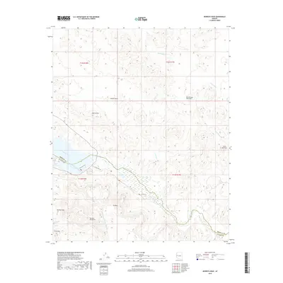
2018 Map of Monkeys Head
USGS Topo · Published 2018About this map
The Bill Williams River meanders through this arid landscape, defining the border between Mohave and La Paz counties. This 2018 survey reveals a terrain dominated by the Buckskin Mountains and the Bill Williams Mountains, where drainage systems like Paloma Wash and Fox Wash carve through the Mojave Desert. The presence of the Central Arizona Project Aqueduct highlights modern water management infrastructure cutting across the rugged topography. Hikers and researchers can trace the Shoreline Trail and the local Hiking Trail near the riverbanks. Distinctive landmarks such as the Monkeys Head rock formation, Castle Rock, and the Aubrey Hills serve as important navigational points for those exploring this sparsely settled region of the American Southwest.
Find a feature on this map
22 named features on this map. Tap any name to fly to it.
Don’t see what you’re looking for? This feature index may not catch every label — zoom into the map to look around manually.
Map Details
Editions of this 2018 Monkeys Head Map
This is the sole edition of this map. No revisions or reprints were ever made.
Other maps of this area

1911 · Parker
USGS Topo · 1:125,000

1923 · Signal
USGS Topo · 1:250,000

1942 · Signal
USGS Topo · 1:250,000

1943 · Giers Basin
USGS Topo · 1:62,500

1950 · Parker Dam Area
USGS Topo · 1:62,500

1950 · Prescott
USGS Topo · 1:250,000

1954 · Needles
USGS Topo · 1:250,000

1954 · Prescott
USGS Topo · 1:250,000

1956 · Needles
USGS Topo · 1:250,000

1958 · Prescott
USGS Topo · 1:250,000