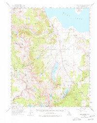
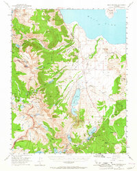
1953 Map of Mono Craters
USGS Topo · Published 1978About this map
Yosemite National Park dominates the western reaches of this 1953 survey, where high-altitude landmarks like the Dana Plateau and Donohue Pass mark the crest of the Sierra Nevada. The terrain drops sharply toward the east into the volcanic basin of the Pumice Valley, a stark contrast to the glacial lakes and granite peaks. The settlement at Lee Vining and the Lee Vining PO serve as the primary gateway along Highway 395, while the recreation-focused community of June Lake is established further south.
Find a feature on this map
85 named features on this map. Tap any name to fly to it.
Don’t see what you’re looking for? This feature index may not catch every label — zoom into the map to look around manually.
Map Details
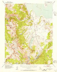
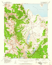
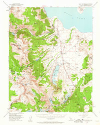
Editions of this 1953 Mono Craters Map
6 editions found
Other maps of this area

1901 · Mt. Lyell
USGS Topo · 1:125,000

1909 · Hawthorne
USGS Topo · 1:250,000

1909 · Bridgeport
USGS Topo · 1:125,000

1911 · Bridgeport
USGS Topo · 1:125,000

1911 · Hawthorne
USGS Topo · 1:250,000

1914 · Mt. Morrison
USGS Topo · 1:125,000

1915 · Hawthorne
USGS Topo · 1:250,000

1920 · Bridgeport
USGS Topo · 1:125,000

1947 · Mariposa
USGS Topo · 1:250,000

1948 · Walker Lake
USGS Topo · 1:250,000