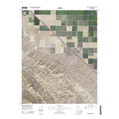
2015 Map of Monocline Ridge
USGS Topo · Published 2015About this map
Monocline Ridge rises sharply from the Central Valley, creating a stark geological boundary between the flat agricultural lands of the San Joaquin Valley and the rising elevations of the Diablo Range. This landscape illustrates the transition from the grid-aligned roads of the valley floor, such as W Manning Ave and S Jerrold Ave, to the more complex topography of the Tumey Hills and Ciervo Hills. Several established agricultural outposts, including Chounet Ranch and Chaney Ranch, are situated along the base of these hills, marking the intersection of ranching operations and the seasonal drainage of Tumey Gulch. The boundary between Fresno County and San Benito County cuts across the southwestern portion of the sheet, where the terrain reaches towards Ciervo Mountain.
Find a feature on this map
30 named features on this map. Tap any name to fly to it.
Don’t see what you’re looking for? This feature index may not catch every label — zoom into the map to look around manually.
Map Details
Editions of this 2015 Monocline Ridge Map
This is the sole edition of this map. No revisions or reprints were ever made.
Other maps of this area

1912 · Coalinga
USGS Topo · 1:125,000

1913 · Panoche
USGS Topo · 1:125,000

1915 · Priest Valley
USGS Topo · 1:125,000

1921 · Tierra Loma School
USGS Topo · 1:31,680

1922 · Tufts Ranch
USGS Topo · 1:31,680

1922 · Chaney Ranch
USGS Topo · 1:31,680

1923 · Levis
USGS Topo · 1:31,680

1923 · Tierra Loma School
USGS Topo · 1:31,680

1923 · Monocline Ridge
USGS Topo · 1:31,680

1943 · New Idria
USGS Topo · 1:62,500