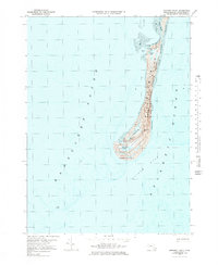
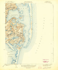
1974 Map of Monomoy Point
USGS Topo · Published 1984About this map
Monomoy Point stands at the southern tip of a dynamic coastal barrier, largely encompassed by the Monomoy National Wildlife Refuge. This mid-1970s topographical record captures the fragile geography of the peninsula, which separates the Nantucket Sound from the Atlantic Ocean. The landscape is dominated by shifting Barrier Dunes and expansive tidal flats, with interior freshwater and salt marshes like Lighthouse Marsh and Station Pond Marsh providing critical habitat. A notable landmark of maritime history is the Lighthouse (Abandoned) near the southern hook, a silent indicator of the area's navigational importance before automation and environmental shifts changed the coast. Small water bodies like Hospital Pond and Big Station Pond dot the interior, while the deep waters of Butler Hole lie just offshore, marking the transition into the open sea.
Find a feature on this map
17 named features on this map. Tap any name to fly to it.
Don’t see what you’re looking for? This feature index may not catch every label — zoom into the map to look around manually.
Map Details
Editions of this 1974 Monomoy Point Map
3 editions found
Other maps of this area

1887 · Yarmouth
USGS Topo · 1:62,500

1888 · Chatham
USGS Topo · 1:62,500

1889 · Yarmouth
USGS Topo · 1:62,500

1893 · Chatham
USGS Topo · 1:62,500

1893 · Yarmouth
USGS Topo · 1:62,500

1917 · Chatham
USGS Topo · 1:62,500

1942 · Cape Cod Bay
USGS Topo · 1:125,000
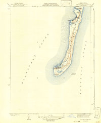
1942 · Monomoy Point
USGS Topo · 1:31,680
1942 · Chatham
USGS Topo · 1:31,680

1942 · Nauset
USGS Topo · 1:125,000