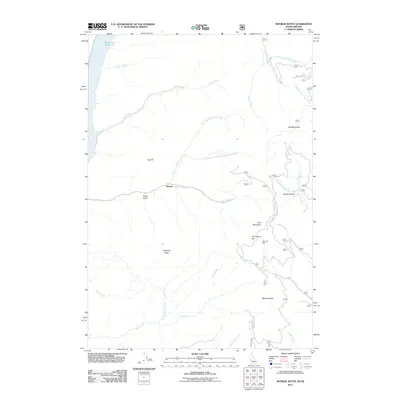
2011 Map of Monroe Butte
USGS Topo · Published 2011About this map
Brownlee Reservoir defines the western edge of this rugged landscape in Baker County, where the high-elevation terrain of the Hitt Mountains and peaks like Iron Mountain dictate the drainage patterns of the region. The map documents the isolated settlement of Mineral, located along Dennett Creek, which serves as a central point for historic mining activity in the area. Evidence of the region's extraction history is specifically noted at the Mortimer Mine, situated south of the distinctive Chinamans Hat formation. Numerous watercourses, including Sturgill Creek and Wolf Creek, carve through the complex topography between named summits like Monroe Butte and McChord Butte. The inclusion of the Natl Forest Develop Road 010 Trl highlights the area's role within managed forest lands, where early infrastructure supports both resource management and mountain access.
Find a feature on this map
30 named features on this map. Tap any name to fly to it.
Don’t see what you’re looking for? This feature index may not catch every label — zoom into the map to look around manually.
Map Details
Editions of this 2011 Monroe Butte Map
This is the sole edition of this map. No revisions or reprints were ever made.
Other maps of this area

1897 · Weiser
USGS Topo · 1:125,000

1915 · Pine
USGS Topo · 1:125,000

1952 · Olds Ferry NW
USGS Topo · 1:24,000

1952 · Olds Ferry
USGS Topo · 1:62,500

1953 · Mann Creek
USGS Topo · 1:62,500

1955 · Baker
USGS Topo · 1:250,000

1957 · Sturgill Peak
USGS Topo · 1:62,500

1957 · Mineral
USGS Topo · 1:62,500

1959 · Baker
USGS Topo · 1:250,000

1980 · McCall
USGS Topo · 1:100,000