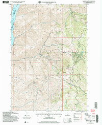
2004 Map of Monroe Butte
USGS Topo · Published 2007About this map
Payette National Forest dominates this vertical Idaho landscape, where the Hitt Mountains rise sharply above the Snake River corridor. The 2004 revision reveals a terrain defined by extensive resource extraction and high-elevation landmarks. Notable peaks such as Monroe Butte, Iron Mountain, and Chinamans Hat overlook a series of steep drainage basins including Barton Gulch Creek and Tartan Gulch. The western edge of the quadrangle is marked by the Brownlee Reservoir, creating a sharp border between Washington County and the neighboring state of Oregon.
Find a feature on this map
39 named features on this map. Tap any name to fly to it.
Don’t see what you’re looking for? This feature index may not catch every label — zoom into the map to look around manually.
Map Details
Editions of this 2004 Monroe Butte Map
This is the sole edition of this map. No revisions or reprints were ever made.
Other maps of this area

1897 · Weiser
USGS Topo · 1:125,000

1915 · Pine
USGS Topo · 1:125,000

1952 · Olds Ferry NW
USGS Topo · 1:24,000

1952 · Olds Ferry
USGS Topo · 1:62,500

1953 · Mann Creek
USGS Topo · 1:62,500

1955 · Baker
USGS Topo · 1:250,000

1957 · Sturgill Peak
USGS Topo · 1:62,500

1957 · Mineral
USGS Topo · 1:62,500

1959 · Baker
USGS Topo · 1:250,000

1980 · McCall
USGS Topo · 1:100,000