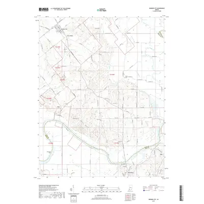
2019 Map of Monroe City
USGS Topo · Published 2019About this map
Monroe City and Petersburg anchor this Indiana landscape where the White River forms a natural boundary between Knox, Pike, and Daviess counties. The river's winding course is marked by the prominent Sevenmile Bend and a stretch known as The Bluffs, while the surrounding terrain is a network of agricultural lands and small drainages like Wilson Cr and Pond Creek. Local history is preserved in several burial grounds, including Freeland Cem and Walnut Hill Cem, which serve as vital markers for genealogical research in this rural region.
Find a feature on this map
105 named features on this map. Tap any name to fly to it.
Don’t see what you’re looking for? This feature index may not catch every label — zoom into the map to look around manually.
Map Details
Editions of this 2019 Monroe City Map
This is the sole edition of this map. No revisions or reprints were ever made.
Other maps of this area

1902 · Ditney
USGS Topo · 1:125,000

1903 · Velpen
USGS Topo · 1:62,500

1903 · Petersburg
USGS Topo · 1:62,500

1942 · Fritchton
USGS Topo · 1:24,000

1944 · Fritchton
USGS Topo · 1:24,000

1944 · Washington
USGS Topo · 1:24,000

1944 · Monroe City
USGS Topo · 1:24,000

1944 · Wheatland
USGS Topo · 1:24,000

1944 · Iona
USGS Topo · 1:24,000

1945 · Sandy Hook
USGS Topo · 1:24,000