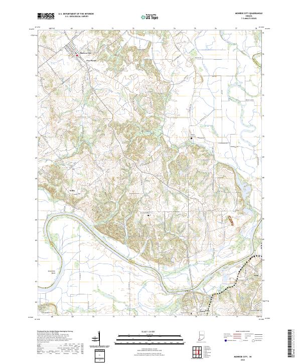
2022 Map of Monroe City
USGS Topo · Published 2022About this map
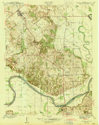
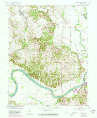
Monroe City serves as the primary hub in this southwestern Indiana landscape, where the street grid of Five Points transitions into a network of rural roads and orchards. To the south, the White River carves a winding path through the Beech Hills and around the dramatic curve of Sevenmile Bend, defining the boundary between Knox, Pike, and Daviess counties. This area is characterized by the tension between the river’s natural floodplain and the extensive drainage projects designed to reclaim the land for agriculture.
Find a feature on this map
113 named features on this map. Tap any name to fly to it.
Don’t see what you’re looking for? This feature index may not catch every label — zoom into the map to look around manually.
Map Details
Editions of this 2022 Monroe City Map
This is the sole edition of this map. No revisions or reprints were ever made.
Historical Maps of Pond Creek Mills Through Time
3 maps found