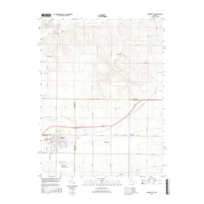
2014 Map of Monroe City
USGS Topo · Published 2014About this map
Monroe City sits at the nexus of three Missouri counties, serving as a regional hub where the borders of Marion, Ralls, and Monroe counties converge. This landscape is defined by the headwaters and tributaries of several drainage systems, most notably Sees Cr and its various branches, along with the South Fork North River to the north. The town's grid is well-established, featuring community landmarks such as Saint Jude Cemetery and the Captain Ben Smith Airfield - Monroe City Airport to the south.
Find a feature on this map
82 named features on this map. Tap any name to fly to it.
Don’t see what you’re looking for? This feature index may not catch every label — zoom into the map to look around manually.
Map Details
Editions of this 2014 Monroe City Map
This is the sole edition of this map. No revisions or reprints were ever made.
Other maps of this area

1903 · Palmyra
USGS Topo · 1:125,000

1948 · Quincy
USGS Topo · 1:250,000

1949 · Palmyra
USGS Topo · 1:24,000

1949 · Philadelphia
USGS Topo · 1:24,000

1950 · Palmyra
USGS Topo · 1:24,000

1950 · Philadelphia
USGS Topo · 1:24,000

1956 · Quincy
USGS Topo · 1:250,000
1958 · Rensselaer
USGS Topo · 1:24,000

1959 · Monroe City
USGS Topo · 1:24,000

1959 · Joanna
USGS Topo · 1:24,000