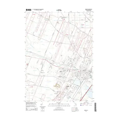
2014 Map of Monroe
USGS Topo · Published 2014About this map
Monroe and its surrounding townships appear here along the western shores of Lake Erie, defined by the winding course of the River Raisin. This area is a significant landscape of American military history, anchored by the River Raisin National Battlefield Park and the nearby Kentucky Soldiers Park Cem. The map illustrates a dense network of residential expansion in neighborhoods like Patterson Gardens, Evergreen Acres, and West Monroe, while the northern reaches maintain a more traditional agrarian grid interrupted by numerous drainage features such as Bluebush Drain and Schesberger Drain. Genealogists will find a high concentration of burial sites, including the Holy Ghost Evangelical Lutheran Cem and Saint Paul's German Lutheran Cem, reflecting the region's deep denominational roots. Institutional landmarks like Monroe County Community Coll and Custer Airport further mark the mid-century development of this Lake Erie coastal community.
Find a feature on this map
201 named features on this map. Tap any name to fly to it.
Don’t see what you’re looking for? This feature index may not catch every label — zoom into the map to look around manually.
Map Details
Editions of this 2014 Monroe Map
This is the sole edition of this map. No revisions or reprints were ever made.
Other maps of this area

1902 · Ypsilanti
USGS Topo · 1:62,500

1904 · Ann Arbor
USGS Topo · 1:125,000

1906 · Ypsilanti
USGS Topo · 1:62,500

1906 · Romulus
USGS Topo · 1:62,500

1908 · Ann Arbor
USGS Topo · 1:125,000

1912 · Monroe
USGS Topo · 1:62,500

1912 · Dundee
USGS Topo · 1:62,500

1914 · Monroe
USGS Topo · 1:62,500

1926 · Dundee
USGS Topo · 1:62,500

1927 · Monroe
USGS Topo · 1:31,680
Featured Places
- Frenchtown Charter Township, MI
- Monroe, MI
- Monroe Charter Township, MI
- South Monroe, Monroe Charter Township
- Raisinville Township, MI