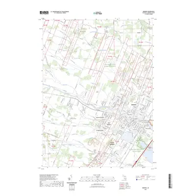
2023 Map of Monroe
USGS Topo · Published 2023About this map
Monroe serves as the focal point of this coastal Michigan landscape, situated where the River Raisin flows toward Lake Erie. The city is flanked by a network of suburban and outlying developments including West Monroe, Evergreen Acres, and Patterson Gardens. This contemporary survey highlights the area's deep history through the River Raisin National Battlefield Park and numerous historic burial sites such as the Old Burial Ground and Saint Joseph Cem.
Find a feature on this map
228 named features on this map. Tap any name to fly to it.
Don’t see what you’re looking for? This feature index may not catch every label — zoom into the map to look around manually.
Map Details
Editions of this 2023 Monroe Map
This is the sole edition of this map. No revisions or reprints were ever made.
Other maps of this area

1902 · Ypsilanti
USGS Topo · 1:62,500

1904 · Ann Arbor
USGS Topo · 1:125,000

1906 · Ypsilanti
USGS Topo · 1:62,500

1906 · Romulus
USGS Topo · 1:62,500

1908 · Ann Arbor
USGS Topo · 1:125,000

1912 · Monroe
USGS Topo · 1:62,500

1912 · Dundee
USGS Topo · 1:62,500

1914 · Monroe
USGS Topo · 1:62,500

1926 · Dundee
USGS Topo · 1:62,500

1927 · Monroe
USGS Topo · 1:31,680
Featured Places
- Frenchtown Charter Township, MI
- Monroe, MI
- Monroe Charter Township, MI
- South Monroe, Monroe Charter Township
- Raisinville Township, MI