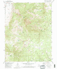
1980 Map of Monroe Peak
USGS Topo · Published 1981About this map
Fishlake National Forest dominates this 1980 survey, revealing a landscape defined by water management and high-altitude recreation. The northern reaches show the edges of Monroe, where the South Bend Canal and Bertlesen Ditch navigate the base of the mountains near a Gravel Pit and Power Plant. As the terrain rises toward Monroe Peak, the map documents a network of pack trails and jeep trails connecting remote locations like Oscars Vision and the Devils Dutch Oven.
Find a feature on this map
62 named features on this map. Tap any name to fly to it.
Don’t see what you’re looking for? This feature index may not catch every label — zoom into the map to look around manually.
Map Details
Editions of this 1980 Monroe Peak Map
2 editions found
Other maps of this area

1885 · Beaver
USGS Topo · 1:250,000

1885 · Fish Lake
USGS Topo · 1:250,000

1896 · Fish Lake
USGS Topo · 1:250,000

1940 · Monroe
USGS Topo · 1:62,500

1944 · Monroe
USGS Topo · 1:62,500

1945 · Marysvale
USGS Topo · 1:62,500

1947 · Marysvale
USGS Topo · 1:62,500

1953 · Richfield
USGS Topo · 1:250,000

1956 · Salina
USGS Topo · 1:250,000

1958 · Richfield
USGS Topo · 1:250,000