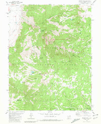
1980 Map of Monroe Peak
USGS Topo · Published 1981About this map
The town of Monroe sits at the edge of a high-altitude wilderness where water management and recreation define the local economy. Established water works like the South Bend Canal, Bertlesen Ditch, and a Power Plant illustrate the irrigation and infrastructure required to support life at the base of Glenwood Mountain. The rugged geography of the Fishlake National Forest dominates the sheet, featuring high-country landmarks such as Monroe Peak and the varied alpine terrain of Monroe Meadows and Sage Flat. For those exploring the backcountry, the map details a network of Pack Trails and Jeep Trails leading to remote locales like Monrovian Park Campground, Fitzgerald Park, and Mud Lake. The convergence of Monroe Creek with its numerous forks, including the First Lefthand Fork and Second Lefthand Fork, highlights the complex drainage system of this part of the Sevier and Piute county line.
Find a feature on this map
52 named features on this map. Tap any name to fly to it.
Don’t see what you’re looking for? This feature index may not catch every label — zoom into the map to look around manually.
Map Details
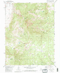
Editions of this 1980 Monroe Peak Map
2 editions found
Other maps of this area

1885 · Beaver
USGS Topo · 1:250,000

1885 · Fish Lake
USGS Topo · 1:250,000

1896 · Fish Lake
USGS Topo · 1:250,000

1940 · Monroe
USGS Topo · 1:62,500

1944 · Monroe
USGS Topo · 1:62,500

1945 · Marysvale
USGS Topo · 1:62,500

1947 · Marysvale
USGS Topo · 1:62,500

1953 · Richfield
USGS Topo · 1:250,000

1956 · Salina
USGS Topo · 1:250,000

1958 · Richfield
USGS Topo · 1:250,000