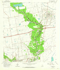
1961 Map of Mont Belvieu
USGS Topo · Published 1964About this map
Barbers Hill dominates this landscape, rising above the surrounding coastal plains as a prominent salt dome and focal point for the Barbers Hill Oil Field. This elevated landform serves as the foundation for the town of Mont Belvieu, which sits atop the geological feature. The map captures an era of heavy industrial infrastructure, evidenced by the dense network of pipelines, oil wells, and sludge pits concentrated around the dome and the nearby Jergins Oil Field.
Find a feature on this map
55 named features on this map. Tap any name to fly to it.
Don’t see what you’re looking for? This feature index may not catch every label — zoom into the map to look around manually.
Map Details
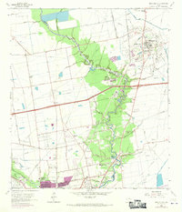
Editions of this 1961 Mont Belvieu Map
2 editions found
Other maps of this area

1916 · Burnett Bay
USGS Topo · 1:24,000

1916 · Crosby
USGS Topo · 1:24,000

1916 · Morgan Point
USGS Topo · 1:24,000

1916 · Cedar Bayou
USGS Topo · 1:24,000

1916 · La Porte
USGS Topo · 1:24,000

1919 · Morgan Point
USGS Topo · 1:31,680

1919 · Crosby
USGS Topo · 1:31,680

1919 · Cedar Bayou
USGS Topo · 1:31,680

1920 · La Porte
USGS Topo · 1:31,680

1920 · Highlands
USGS Topo · 1:31,680