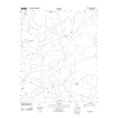
2011 Map of Mont Clare
USGS Topo · Published 2011About this map
The Great Pee Dee River defines the northern and eastern boundaries of this Darlington County landscape, winding through a series of sharp bends and oxbows like Williams Lake. This 2011 survey reveals a rural South Carolina interior where modern water management, seen in several dammed structures such as the South Carolina Noname 16013 Dam, coexists with long-standing agricultural and family landmarks. Small communities like Mont Clare and Gandy serve as focal points for a network of local roads including Society Hill Road and Lumber Road.
Find a feature on this map
52 named features on this map. Tap any name to fly to it.
Don’t see what you’re looking for? This feature index may not catch every label — zoom into the map to look around manually.
Map Details
Editions of this 2011 Mont Clare Map
This is the sole edition of this map. No revisions or reprints were ever made.
Other maps of this area

1942 · Rockingham
USGS Topo · 1:125,000

1943 · Gum Swamp
USGS Topo · 1:62,500

1953 · Florence
USGS Topo · 1:250,000

1954 · Florence
USGS Topo · 1:250,000

1963 · Dovesville
USGS Topo · 1:24,000

1963 · Mont Clare
USGS Topo · 1:24,000

1963 · Darlington East
USGS Topo · 1:24,000

1963 · Darlington West
USGS Topo · 1:24,000

1971 · Society Hill
USGS Topo · 1:24,000
1972 · Cash
USGS Topo · 1:24,000