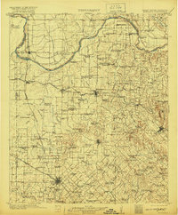
1905 Map of Montague
USGS Topo · Published 1920About this map
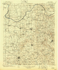
The Red River marks the northern boundary of this 1905 landscape, defining the edge of Montague County where it meets the Chickasaw Nation. This territory reflects a time of active river crossings and establishing rail routes, with numerous ferries like Yellowbank Ferry and Petersburg Ferry serving travelers before the era of modern bridges. The network of schools, including the curiously named Battle-ax School and Pigtail School, suggests a distributed rural population tied to the land. Significant rail hubs like Bowie and Nocona appear at the intersections of lines such as the Chicago Rock Island and Gulf R.R. and the Fort Worth and Denver City R.R.. High points like Queens Peak and Dead Ox Mound provided essential landmarks for surveyors and settlers in a region where the topography transitions from the river bends of Spanish Fort Bend to the headwaters of the West Fork Trinity River.
Find a feature on this map
153 named features on this map. Tap any name to fly to it.
Don’t see what you’re looking for? This feature index may not catch every label — zoom into the map to look around manually.
Map Details
Editions of this 1905 Montague Map
3 editions found
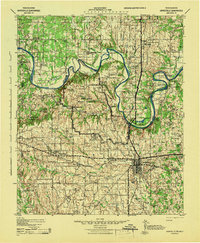
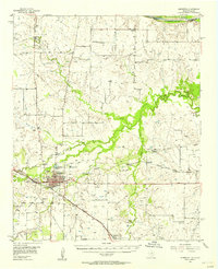
Other maps of this area

1901 · Addington
USGS Topo · 1:125,000

1901 · Ardmore
USGS Topo · 1:125,000

1902 · Gainesville
USGS Topo · 1:125,000

1905 · Montague
USGS Topo · 1:125,000

1918 · Ardmore
USGS Topo · 1:125,000
1943 · Gainesville
USGS Topo · 1:125,000

1954 · Sherman
USGS Topo · 1:250,000

1954 · Wichita Falls
USGS Topo · 1:250,000

1955 · Lawton
USGS Topo · 1:250,000
1956 · Henrietta
USGS Topo · 1:62,500