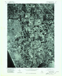
1976 Map of Montague SE
USGS Topo · Published 1979About this map
North Muskegon and the surrounding coastal landscape are captured in high detail through this orthophotographic survey. The imagery reveals the mid-1970s development patterns between the prominent shoreline of Lake Michigan and the protected waters of Muskegon Lake and Bear Lake. Unlike traditional topographic maps, this aerial view provides a direct look at the parceling of land, woodlots, and the emerging residential footprints in areas like Lakewood and Dalton. The contrast between the dense vegetation of the dunes and the geometric grids of local farms and neighborhoods illustrates the region's transition into a more suburban character during this era. Researchers can observe the exact road alignments and land-use divisions that defined this part of the Michigan coast just before the close of the 1970s.
Find a feature on this map
6 named features on this map. Tap any name to fly to it.
Don’t see what you’re looking for? This feature index may not catch every label — zoom into the map to look around manually.
Map Details
Editions of this 1976 Montague SE Map
This is the sole edition of this map. No revisions or reprints were ever made.
Other maps of this area

1929 · Montague
USGS Topo · 1:48,000

1930 · Lake Harbor
USGS Topo · 1:48,000

1930 · Muskegon
USGS Topo · 1:62,500

1936 · Muskegon
USGS Topo · 1:62,500

1936 · Lake Harbor
USGS Topo · 1:62,500

1954 · Milwaukee
USGS Topo · 1:250,000

1958 · Milwaukee
USGS Topo · 1:250,000

1958 · Twin Lake
USGS Topo · 1:62,500

1959 · Montague
USGS Topo · 1:62,500
1972 · Muskegon West
USGS Topo · 1:24,000