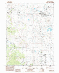
1984 Map of Montague
USGS Topo · Published 1986About this map
Montague serves as a central hub in the northern reaches of the Shasta Valley during the early 1980s, where the Southern Pacific railroad line intersects with local commerce and aviation at the Montague Yreka Airport. The landscape is defined by the winding course of the Shasta River and its many tributaries, including Julien Creek and the Little Shasta River. To the south, the settlement of Grenada sits along the rail line near the Julien Cemetery, illustrating the linear development patterns typical of this valley's history.
Find a feature on this map
31 named features on this map. Tap any name to fly to it.
Don’t see what you’re looking for? This feature index may not catch every label — zoom into the map to look around manually.
Map Details
Editions of this 1984 Montague Map
2 editions found
Other maps of this area

1886 · Shasta
USGS Topo · 1:250,000

1894 · Shasta
USGS Topo · 1:250,000

1921 · Shasta Valley Sheet No 6
USGS Topo · 1:24,000

1921 · Shasta Valley Sheet No 2
USGS Topo · 1:24,000

1922 · Shasta Valley Sheet No 4
USGS Topo · 1:24,000

1922 · Shasta Valley Sheet No 3
USGS Topo · 1:24,000

1922 · Shasta Valley Sheet No 3 S
USGS Topo · 1:24,000

1922 · Shasta Valley Sheet No 5
USGS Topo · 1:24,000

1932 · Yreka
USGS Topo · 1:96,000

1934 · Macdoel
USGS Topo · 1:96,000