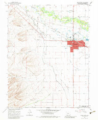
1964 Map of Monte Vista
USGS Topo · Published 1983About this map
Monte Vista serves as the focal point of this mid-1960s survey, situated where the Rio Grande meets a complex network of agricultural infrastructure. The landscape is defined by its early water management, featuring the Monte Vista Canal, Swede Ditch, and the combined Denver and Rio Grande Western and Lariat Canal. These waterways supported the development of small settlements like Torres, Lariat, and Maxeyville, alongside civic staples such as St Joseph Sch and Central Sch.
Find a feature on this map
52 named features on this map. Tap any name to fly to it.
Don’t see what you’re looking for? This feature index may not catch every label — zoom into the map to look around manually.
Map Details
Editions of this 1964 Monte Vista Map
3 editions found
Other maps of this area

1915 · Del Norte
USGS Topo · 1:125,000

1917 · Del Norte
USGS Topo · 1:125,000

1922 · Conejos
USGS Topo · 1:125,000

1945 · Durango
USGS Topo · 1:250,000

1953 · Durango
USGS Topo · 1:250,000

1954 · Durango
USGS Topo · 1:250,000

1961 · Durango
USGS Topo · 1:250,000

1963 · Durango
USGS Topo · 1:250,000

1964 · Sevenmile Plaza
USGS Topo · 1:24,000

1964 · Monte Vista
USGS Topo · 1:24,000