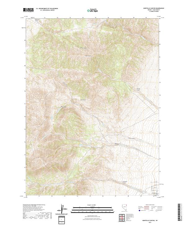
2021 Map of Montello Canyon
USGS Topo · Published 2021About this map
The Leach Range dominates this corner of Elko County, defining a landscape shaped by narrow canyons and vital high-desert water sources. In this arid reach of eastern Nevada, the drainage systems of Gamble Cr, Hoppie Cr, and Charley Cr create a network of seasonal waterways that have historically dictated movement and land use. The presence of Hoppie Basin Spring and Montello Springs highlights the critical points where groundwater reaches the surface, supporting the surrounding rangeland. To the southeast, a grid of residential streets including Oak St, Pine St, and Maple St indicates localized development near the canyon mouth. The map also traces the winding path of Hoppie Canyon Rd as it climbs through the complex topography of Hoppie Basin, providing a detailed look at the infrastructure required to navigate this portion of the Great Basin.
Find a feature on this map
29 named features on this map. Tap any name to fly to it.
Don’t see what you’re looking for? This feature index may not catch every label — zoom into the map to look around manually.
Map Details
Editions of this 2021 Montello Canyon Map
This is the sole edition of this map. No revisions or reprints were ever made.
Other maps of this area

1955 · Wells
USGS Topo · 1:250,000

1958 · Wells
USGS Topo · 1:250,000

1961 · Wells
USGS Topo · 1:250,000

1967 · Valley Pass
USGS Topo · 1:24,000

1967 · Loray
USGS Topo · 1:24,000

1967 · Montello Canyon
USGS Topo · 1:24,000

1967 · Twelvemile Ranch
USGS Topo · 1:24,000

1967 · Montello
USGS Topo · 1:24,000

1967 · Ninemile Mtn NE
USGS Topo · 1:24,000
1967 · Pilot Peak NW
USGS Topo · 1:24,000