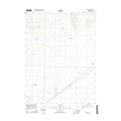
2014 Map of Montello
USGS Topo · Published 2014About this map
Montello sits at the intersection of desert drainage systems and ranching history in this northeastern Nevada survey. The town's grid, including 1st St and Sycamore St, occupies a strategic point where Hoppie Cr and Montello Cr converge before entering the expansive Tecoma Valley. The landscape is defined by its intermittent water sources, such as Gamble Spring and Warm Springs, which have long dictated human activity in this arid basin. To the north, Juniper Airport serves as a remote outpost near the winding path of Gamble Cr. The map captures the intricate network of washes and canyons, including Gamble Canyon and Loray Wash, illustrating how water shaped both the physical terrain and the placement of local infrastructure like CR 765.
Find a feature on this map
22 named features on this map. Tap any name to fly to it.
Don’t see what you’re looking for? This feature index may not catch every label — zoom into the map to look around manually.
Map Details
Editions of this 2014 Montello Map
This is the sole edition of this map. No revisions or reprints were ever made.
Other maps of this area

1955 · Wells
USGS Topo · 1:250,000

1958 · Wells
USGS Topo · 1:250,000

1961 · Wells
USGS Topo · 1:250,000

1967 · Jackson Spring
USGS Topo · 1:24,000

1967 · Loray
USGS Topo · 1:24,000

1967 · Montello Canyon
USGS Topo · 1:24,000

1967 · Twelvemile Ranch
USGS Topo · 1:24,000

1967 · Patterson Pass
USGS Topo · 1:24,000

1967 · Montello
USGS Topo · 1:24,000

1967 · Ninemile Mtn NE
USGS Topo · 1:24,000