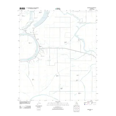
2012 Map of Monterey
USGS Topo · Published 2012About this map
Monterey serves as the central hub of this Concordia Parish landscape, situated near the intersection of several local routes like Ferrell Rd and Parhams Rd. The settlement is defined by its proximity to a complex network of waterways, including Black River Lake and the winding Bayou Cocodrie. This 2012 survey illustrates a region where agriculture and resource extraction coexist, evidenced by the numerous energy production areas scattered across the quadrangle, such as the South Monterey Oil Field and the Northwest Bayou Cocodrie Oil Field.
Find a feature on this map
53 named features on this map. Tap any name to fly to it.
Don’t see what you’re looking for? This feature index may not catch every label — zoom into the map to look around manually.
Map Details
Editions of this 2012 Monterey Map
This is the sole edition of this map. No revisions or reprints were ever made.
Other maps of this area

1909 · Sycamore Landing
USGS Topo · 1:24,000

1935 · Tooleys
USGS Topo · 1:62,500

1939 · Red Gum
USGS Topo · 1:62,500

1939 · Deer Park
USGS Topo · 1:62,500

1941 · Manifest
USGS Topo · 1:62,500

1941 · Tooleys
USGS Topo · 1:62,500

1953 · Natchez
USGS Topo · 1:250,000

1956 · Natchez
USGS Topo · 1:250,000

1959 · Natchez
USGS Topo · 1:250,000

1960 · Jonesville
USGS Topo · 1:62,500