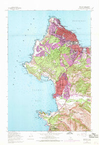
1947 Map of Monterey
USGS Topo · Published 1969About this map
Monterey and the surrounding coastline of the Monterey Peninsula are depicted here during a period of significant post-war expansion. Urban development, noted by the purple tints from a 1968 photorevision, shows the growth of New Monterey and Pacific Grove as they densify around the Southern Pacific rail line. The map highlights the intersection of luxury and nature, with the famous Seventeen Mile Drive winding through the hills past Forest Lake and the Pebble Beach Riding Stables.
Find a feature on this map
81 named features on this map. Tap any name to fly to it.
Don’t see what you’re looking for? This feature index may not catch every label — zoom into the map to look around manually.
Map Details
Editions of this 1947 Monterey Map
5 editions found
Other maps of this area

1913 · Monterey
USGS Topo · 1:62,500

1918 · Point Sur
USGS Topo · 1:62,500

1925 · Point Sur
USGS Topo · 1:62,500

1941 · Monterey
USGS Topo · 1:62,500

1947 · Point Sur
USGS Topo · 1:62,500

1947 · Seaside
USGS Topo · 1:24,000

1947 · Monterey
USGS Topo · 1:62,500
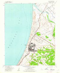
1947 · Marina
USGS Topo · 1:24,000

1947 · Monterey
USGS Topo · 1:24,000

1948 · Santa Cruz
USGS Topo · 1:250,000